There’s a reason locals say the best way to see Curaçao is from behind the wheel. The island is small enough to drive end to end in under two hours — but rich enough to fill a week of exploration. Dramatic cliffs, turquoise bays, colonial architecture, cacti-lined roads, and a sunset that will stop you in your tracks.
This is our definitive road trip guide: seven stops, one island, and everything you need to know to do it right.
Before You Go
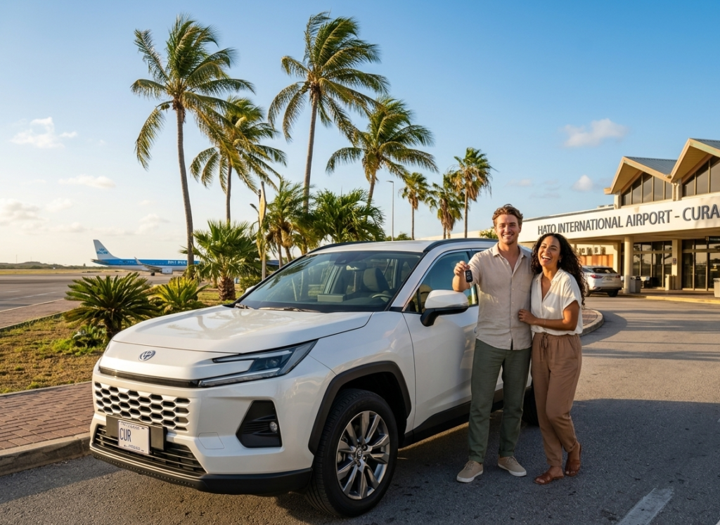
Distance: Willemstad to Westpunt is roughly 65 km each way. Best car: The Toyota Yaris Cross or RAV4 give you the comfort and clearance for unpaved roads. The Agya and Yaris Sedan are perfect if you’re sticking to paved routes. Best day: Start early — ideally by 8 AM. Beaches get crowded by midday, especially on weekends. What to bring: Sunscreen, water, snorkeling gear, cash for beach entrances, and a full tank of fuel.
Stop 1 — Willemstad: Start Where It All Began
📍 Location: Central Curaçao ⏱ Time: 1–2 hours
Every road trip on the island starts in Willemstad — and rightly so. This UNESCO World Heritage city is one of the most photogenic places in the entire Caribbean.
Start at the Handelskade, the iconic row of Dutch colonial buildings painted in vivid pastels that line St Anna Bay. Walk across the Queen Emma Bridge — a floating pontoon bridge that swings open to let ships through — and explore the Otrobanda neighborhood on the other side.
Grab a coffee at one of the waterfront cafés, pick up snacks for the road, and soak in the architecture before the day heats up.
Don’t miss: The view from Fort Amsterdam at sunrise. Worth setting the alarm for.
Stop 2 — Hato Caves: Go Underground
📍 Location: Near Hato, north of Willemstad ⏱ Time: 1 hour
Twenty minutes north of Willemstad, the Hato Caves offer a dramatic change of scenery. Formed over 250,000 years ago, these limestone caverns are filled with stalactites, ancient indigenous pictographs, and an underground lake.
Guided tours run throughout the day and take about 45 minutes. It’s a great early stop before the day gets too hot — and genuinely impressive for anyone who didn’t expect something this atmospheric on a small Caribbean island.
Tip: The caves are open from 9 AM. Arrive early to beat the tour groups.
Stop 3 — Cas Abao Beach: The First Big Swim
📍 Location: Northwest coast, banda abou ⏱ Time: 2–3 hours
After the caves, head northwest toward the beaches. Cas Abao is consistently rated one of the most beautiful beaches in the Caribbean — and for good reason. The water is impossibly clear, the sand is white, and the snorkeling just off the beach is excellent.
There’s a small entrance fee, but facilities are good: sun beds, showers, a bar, and a restaurant. Arrive before 11 AM to claim a good spot.
Snorkeling tip: The reef on the left side of the bay has the best coral and fish. Bring your own gear or rent on-site.
Stop 4 — Grote Knip (Knip Beach): The Postcard Shot
📍 Location: Northwest, near Westpunt ⏱ Time: 1–2 hours
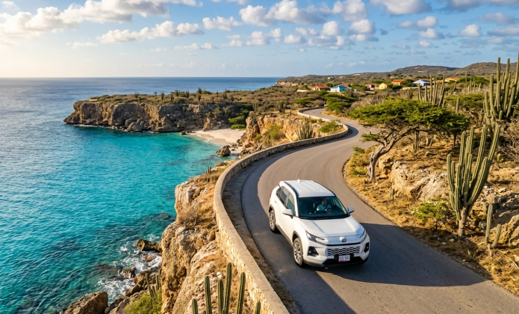
Keep heading northwest and you’ll reach Grote Knip — the beach that ends up on every Curaçao postcard. A sweeping crescent of white sand, flanked by cliffs, with water that shifts from turquoise to deep blue.
The drive there is half the experience. The road narrows and winds through dry tropical landscape, past enormous cacti and divi-divi trees before the bay appears below you like a revelation.
Facilities are more basic than Cas Abao — a snack bar and toilets — but the setting more than compensates. On a quiet weekday, it’s as close to paradise as you’ll find in the Caribbean.
Parking: There’s a small car park at the top of the hill above the beach. Arrive early — it fills up fast.
Stop 5 — Westpunt: Lunch at the Tip
📍 Location: The westernmost point of Curaçao ⏱ Time: 1 hour
The small fishing village of Westpunt sits at the far western tip of the island and feels worlds away from Willemstad. It’s quiet, unhurried, and genuinely local.
Stop for lunch at one of the small local restaurants along the main road — fresh fish, keshi yena, and local stews served without fanfare and without tourist pricing. This is where the island eats.
While you’re here: Walk down to the small beach at Westpunt Bay. The water is calm and the view across to Klein Curaçao on a clear day is extraordinary.
Stop 6 — Shete Boka National Park: The Wild Side
📍 Location: North coast, between Westpunt and Willemstad ⏱ Time: 1–2 hours
On your way back east, pull into Shete Boka National Park — one of the most dramatic and underrated spots on the island. Unlike the calm southern beaches, the north coast faces the open Atlantic, and the waves here are relentless.
The park contains a series of bokas — natural sea inlets carved into the limestone coastline. The most famous is Boka Tabla, where you can walk into a sea cave and watch the waves thunder in beneath your feet. Extraordinary.
Shete Boka is also one of the most important sea turtle nesting sites in the Caribbean. If you visit at the right time (June to October), guided night tours let you watch hawksbill and leatherback turtles come ashore to nest.
Tip: The park road is unpaved and rocky in places. The Yaris Cross or RAV4 handles it with ease. The Agya and Yaris Sedan can manage slowly — just take it carefully.
Stop 7 — Jan Thiel Beach: End the Day Right
📍 Location: East of Willemstad ⏱ Time: 2–3 hours
Round off the road trip with a visit to Jan Thiel Beach, a lively, well-equipped beach on Curaçao’s southeast coast, about 15 minutes east of Willemstad.
Unlike the quieter northwest beaches, Jan Thiel has energy — beach bars, watersports, good restaurants, and a beautiful bay. It’s the perfect place to catch the last of the afternoon sun with a cold Polar beer or a fresh cocktail, recap the day, and ease slowly back toward town.
Where to eat: Hemingway Beach Bar has great cocktails and a view to match. Budget-friendly lunch spots are a short walk from the beach entrance.
The Full Route at a Glance
| Stop | Location | Drive time from previous stop |
|---|---|---|
| 1. Willemstad | Central | — Start here |
| 2. Hato Caves | North | 20 min |
| 3. Cas Abao Beach | Northwest | 35 min |
| 4. Grote Knip | Northwest | 20 min |
| 5. Westpunt | West tip | 15 min |
| 6. Shete Boka | North coast | 25 min (heading back east) |
| 7. Jan Thiel Beach | Southeast | 45 min |
Total driving: Approximately 2.5–3 hours across the full day.
Practical Tips for the Road
Fuel up in Willemstad before heading northwest — petrol stations become sparse once you leave the city. There’s one station near Westpunt but don’t rely on it.
Carry cash — several beaches and the national parks charge entrance fees, and smaller local restaurants often don’t accept cards.
Roads: Most main roads are in good condition. The road to Cas Abao and the Shete Boka park road have unpaved sections. Nothing challenging, but worth knowing.
Speed limits: 80 km/h on main roads, 40–60 km/h in built-up areas. Enforcement exists.
GPS: Google Maps works well across the island. Download the offline map before you leave — signal drops in a few spots.
Ready to Hit the Road?
This road trip works best with a car that gives you the freedom to stop wherever you want, stay as long as you like, and take the scenic detour without a second thought. That’s exactly what IslandGo is here for.
All our 2026 Toyota models come with unlimited mileage — so you can drive every kilometer of this route without watching the meter. No upfront payment, free cancellation, and flexible insurance options to suit every traveler.